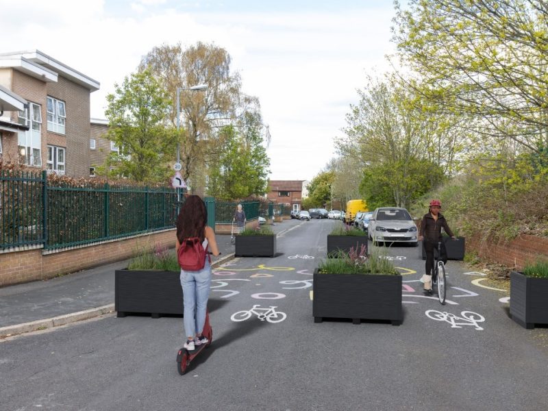
NEW details have been revealed of where many roads will be blocked off in east Bristol as part of a new ‘liveable neighbourhood’ trial.
Motor traffic will be banned from driving through several roads in Barton Hill, Redfield and St George from this autumn.
The liveable neighbourhood trial is aiming to reduce rat-running and through-traffic through residential areas, making it easier and safer to walk and cycle.
Bristol City Council has now published a map detailing exactly where new restrictions will be brought in. Results of the trial will be evaluated before a permanent scheme is introduced early 2025.
A council spokesman said: “We are excited to present our plans for the trial scheme that will help make Barton Hill and parts of Redfield and St George quieter, safer and healthier places to live and spend time. The trial will take place from autumn 2023 and will see a series of measures installed.
“Measures include modal filters, bus gates, pocket parks, changes to one-way and two-way traffic flow, cycle hangars and trees in large planters. We will be installing 10 cycle hangars across the area as part of the trial and will be contacting nearby households about their locations. Once the exact locations have been agreed, residents can sign up to use them.”
New restrictions for motor traffic will be installed on Avonvale Road, Barnes Street, Beaufort Road, Cobden Street, Cossham Road, Ducie Road, Glebe Road, Great Western Lane, Kingsmarsh Way, Lincoln Street, Marsh Lane, Morton Street, the Avenue, and Victoria Avenue. Many of these will comprise large wooden planters placed on the road.
The liveable neighbourhood scheme will cover a wide area south of Lawrence Hill, Church Road and Summerhill Road. The area is bordered by Troopers Hill Road in the east, St Phillips Causeway in the west, and the Feeder Canal and the River Avon in the south.
More details can be found online by visiting: eastbristolliveableneighbourhoods.commonplace.is/
by Alex Seabrook, Local Democracy Reporting Service


